

Europe Snow Report
Austria saw about 40cm of snow in places earlier in the week. Then came a respite before the snow returned. It’s quieter here for the moment but the forecast is for some more 40cm+ totals in the Ski Welt, for example. The new snow may not reach all part of the Austrian Alps, however. The Ski Amade resorts such as Schladming have nothing forecast, and other resorts such as Ischgl, which at 90/30cm could do with a boost, are likely to get only modest amounts around 10cm.
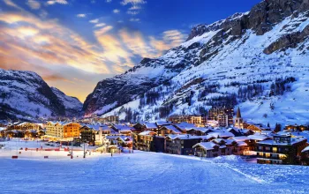
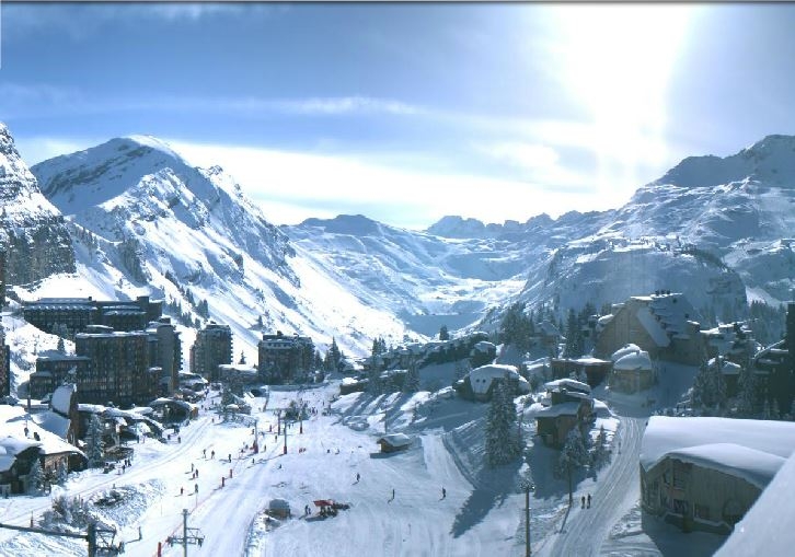
France is skiing beautifully after some epic dumps and the snow has kept pistes topped up all week. Avoriaz (240/190cm) now tops the French charts, along with Flaine (240/155cm) closely followed by Morzine (230/100cm) – a dramatic improvement here on three weeks ago when the town was pretty much snowless. Temperatures have remained cold, a trend which will continue, though after Friday the forecast for the coming week is for no new snow.
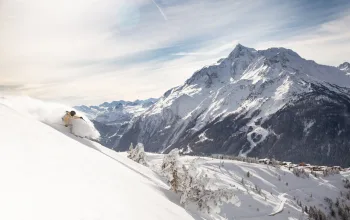
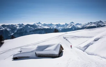
Quieter days ahead in Switzerland too, where recent 40cm+ falls and colder temperatures have kept the on-piste skiing looking lovely. Plenty of avalanche warmings about, though, for off-piste lovers, so do heed local advice. Verbier had a fatality this week, bringing the Swiss avalanche death toll to eight. No change at the top of the Swiss leaderboard with Andermatt (400/70cm) and Engelberg (355/95cm) adding to their impressive upper slopes depths by nearly doubling their base levels. Zermatt was saying goodbye to the snowstorm yesterday with another 20cm+ fall, but the forecast is mist and fog over the coming days.

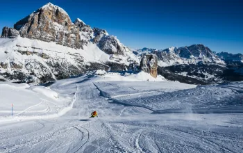
Snow is writing this report from Cortina d’Ampezzo (130/40cm) and can happily report that in the Dolomites, at least, Italy is getting a lovely top up. Plenty of fresh powder about on Thursday meaning the legendary Forcella Rossa was very forgiving this morning! It’s been snowing pretty much everywhere today, meaning some healthy totals are being accumulated at Courmayeur (150/50cm), and Cervinia (245/85cm). But again, once the current dump has ended the forecast is for just the odd centimetre in the coming week. Still decently cold though.
The Pyrenees, has seen more than 2m of fresh snow in the past week, benefitting all the French and Spanish resorts there as well as Andorra. This tiny country has been sorely overlooked in recent years but is staging a comeback – and snow depths such as Arcalis (220/160cm) will do that no harm at all. The Spanish Pyrenees resorts of Formigal (110/40cm) and Baqueira Beret (140/65cm) have seen nearly a metre of new snow by early next week and skiing there is reported as ‘epic’.
Not much new snow to report in Scandinavia. Voss in Norway, (200/120cm) has hung on to its recent big dumps and the coming week should see light dustings most days. Same goes for the rest of Norway’s finest, while across the border in Sweden Are (50/40cm) is reporting fresh snowfall on pistes, but still only has 75% of them open.
In Bulgaria, all resorts saw some fresh snowfall in the past week and another 15-30cm is expected as we head into the weekend.
Scotland has some great snow conditions, and although there’s no new snow on the horizon for the time being, Glencoe (100/70cm) tops the Scottish snow depth charts. Sadly fog is the story for the coming days.
North America snow report
Across the Atlantic, the big story in the US is that at last it’s snowing again in California. Many of the sunshine state’s resorts hadn’t seen fresh snow since late December. Mammoth, Heavenly and the Tahoe area in general can expect up to 60cm this weekend. It’s been snowing today in Eastern resorts such as Stowe, Loon Mountain and Stratton Mountain but Colorado continues its impressive season with the biggest top-up coming at Breckenridge (152/152cm). Clear skies and bright sunshine should make this a perfexct weekend of skiing on fresh powder, then more snow is forecast for the middle of next week.
Dumps of around 10-30cm are forecast in most of western Canada. Except in Whistler. Whistler is predicting that by the time we get to Tuesday morning it will have piled up well over a metre of new snow. Though, again, that’ll mostly be rain at resort level. It’s been quieter back East, where the pistes at Tremblant and Mont Sainte Anne still looking good. Give it a week of no new snow as is forecast, and that might change, of course.

Last word
This week goes to Europe in general where after a dreadfully slow start to the season lasting well into the New Year, most resorts now have respectable totals even at base level, and many are posting upper slope depths above 2 metres. It’s off-piste where the most risk now lies as all that new powder has settled onto a very shaky base. Avalanche risk levels are up to five (out of five) in many places.