

Snow Magazine snow reports in association with Alpine Elements
![]()
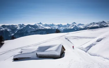
So, you can have too much of a good thing… After bemoaning last season’s lack of snow, European resorts are finding this season’s surfeit of the stuff is bringing a whole different set of problems.
Up to two metres fell in the space of 24-36 hours on Monday and Tuesday across much of the Western Alps, cutting off some resorts, such as Zermatt in Switzerland, stranding delivery vehicles on approach roads, closing pistes as snow fell from tree laden branches onto lift cables in Sestrieres and, worst of all, upping the avalanche risk to the rarely used maximum 5 out of 5.

One of the biggest avalanches occurred at Les Houches in Chamonix, where several chalets were damaged, and many roads were blocked by smaller slides. Val d’Isere and Cervinia were both badly affected by access issues.
Meanwhile, some Austrian resorts were closed due to different problem – strong winds.
However, away from storm central, more moderate snowfalls of around 30cm have enabled many ski areas to continue their best start to a New Year for, well, years!
And the resort with Europe’s deepest snow, Engelberg in Switzerland, has already topped the five-metre mark, registering a depth of 515cm on its upper slopes. Although even that is still behind the mark set by Niseko in Japan, which has clocked up 340cm at base and 630cm at the top.
The good news is that a quieter few days is forecast, before snow returns early next week.
FRANCE
French forecasters have described the snowfall that hit the Alps at the start of this week as a ‘once in 30 years’ event, with up to 1.8m falling in 36 hours in parts of the Savoie area.
Val d’Isere/Tignes, along with the southern alpine resorts such as Isola 2000 and areas that border Italy caught the most of the last storm at the beginning of this week. Snow depths remain impressive in most places, however, and the rest of this week is likely to be quiet with a bit of sun as the clouds lift and everything clears up.

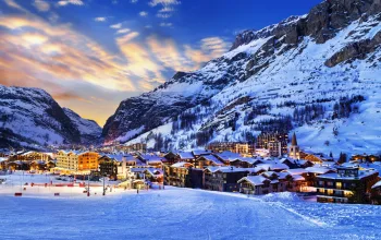
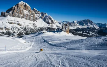
Val d’Isere
Isola 2000 (140/230cm) in the southern French Alps added half a metre to its snow depths at the start of this week, and will enjoy a sunnier end before a little light snow from Sunday.
Val d’Isere and Tignes (260/360cm), where it’s been dumping powder like there’s no tomorrow, have a chance to settle things down before patchy light snow from Sunday turns heavier on Tuesday, with winds picking up too.
The calmer conditions this week – with plenty of sunshine - will allow many other resorts to take stock, but snow depths remain better than for years at La Plagne (190/350cm), Les Arcs (160/310cm), Val Thorens (240/300cm), Avoriaz (200/280cm), Meribel (170/230cm) and Flaine (120/320cm). But keep an eye on what happens around Tuesday…
Flaine

La Plagne
Meribel
Val Thorens
Morzine (80/290cm) suffered last week with high winds and heavy rain damaging exposed slopes. Much of the resort had to close temporarily, but it’s all open again, and it won’t take much for conditions to improve. A sunny end to the week gives way to forecast moderate snowfalls early next week – even at village level.
ITALY
This week began with huge snowfalls in the north west Italian resorts including the Arosa area with up to a metre and a half in three days. Gressoney (200/300cm) has doubled its snow depths in the past week. It’s been dumping powder in border areas such as Sestrieres (80/220cm) and the Milky Way and Cervinia (250/350cm). Although snow is still falling in Cervina, just over the Italian/Swiss border from Zermatt, things are generally calmer now, with the sun set to come out and skiers getting the chance to enjoy all that lush new powder.
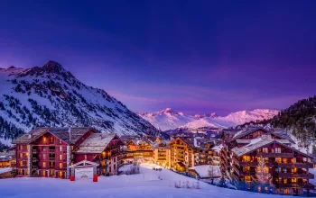
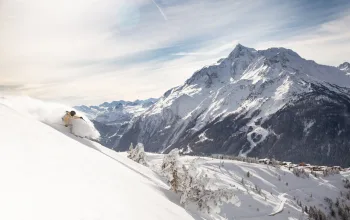
Cervinia
Further east, the Dolomites saw a bit less snow at the start of this week, and snow depths have been topped up to around the 50-60/150-160cm across most of that region. The week ahead sees a mix of a little new snow, mist and freezing fog with Tuesday again the day to watch as signs point to a possible return of heavier snow.
AUSTRIA
The snowfall here was significant but more manageable creating superb skiing conditions at Kaprun (50/310cm) and Solden (160/300cm). Clear skies and chilly double digit minus figures are in store over the next few days, but Tuesday could see a return to snowier weather across the country.
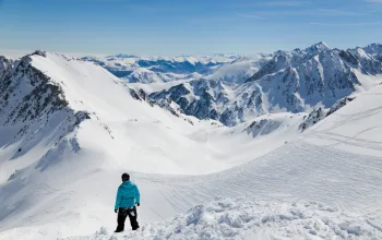
Solden
In the Arlberg it’s a sunny week for Lech (110/170cm) and St Anton (80/250cm). A few light flurries only for the next few days.
Lech
Austria in general is quiet this week – a chance for visitors to really enjoy the best of the recent snowfall. In fact, Schladming (80/120cm) is the resort with the most new snow forecast – a mere 9cm, with that coming from Sunday-Tuesday.
SWITZERLAND
Massive snowfalls left more than 13,000 visitors stuck in Zermatt after more than a metre of snow fell in parts on Monday alone, followed by the same again on Tuesday! Pistes were closed and the avalanche risk is set at the rarely used maximum on a five-point scale. This is the highest it has been for almost 10 years. Last week Zermatt was posting snow depths of 30/150cm; today those figures are 120/320cm. Once the slopes open again – and a much quieter week ahead is forecast, with only 20cm of light to moderate snow – there’ll be masses of deep powder!
Zermatt
It’s snowing in the Bernese Oberland, too, and Wengen (50/140cm), which hosts the latest round of the ski world cup this weekend, had to cancel the first training runs on Tuesday after snow and high winds had damaged infrastructure on the famous Lauberhorn course. Again, things are set to settle down with great skiing conditions now reported.
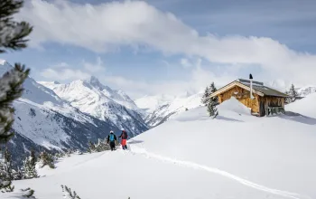
Jungfrau: dawn above the Eiger
Engelberg continues to pile up the snow with 515cm at the top of the mountain.
PYRENEES
While the Alps has taken the headlines, it’s been snowing hard in the Pyrenees too – and there’s a lot more to come here!
On the Spanish side, Formigal (50/130cm) is expecting heavy snow today and tomorrow, a blue sky respite on Friday, then more heavy snow over the weekend and into next week, when high winds will also be a problem.
A little less snowfall and a touch more sun further west in Baqueira Beret (80/140cm), is leaving the resort announcing great skiing conditions. More snow to come from Sunday, however.
Quieter, too, in Andorra where the expert terrain in Arcalis (60/130cm) tops the province’s snow depths but Tuesday next week could herald heavier falls.
Grandvalira, Andorra
And in the French Pyrenees, Bareges in the Grand Tourmalet region (90/130cm) and St Lary (80/190cm) have around half a metre in their forecast, with Saturday night into Sunday looking the heaviest. That’s twice as much as is forecast for the Alps over the next seven days.
SCANDINAVIA
Norway’s seen some good sun and a flurry or two of new snow. Geilo (60/160cm) now has some of the best conditions in the country, along with Voss (50/140cm), but while colder temperatures help keep the snow in good nick, they’ll be hoping more snow materialises early next week.
They’ll be doing a snow dance in Sweden’s main resort of Are (50/60cm) which has only seen a little light snow and could do with even half of what the Alps are getting to improve the ‘packed’ snow conditions. Sadly, no new snow in the forecast here. Similar story in Finland, which is still reporting good skiing conditions despite snow depths still way under a metre.
SLOVENIA
Vogel (70/190cm) still has good snow on the upper slopes, but conditions are wetter lower down. A mix of fog and sun will give way to some longer falls of snow at the start of next week.
SCOTLAND
Highland resorts are enjoying some good ski conditions, despite modest depths, with Glencoe (30/50cm) leading the way. Again, a quiet week with a mix of mist and sun, will be replaced by moderate to heavy snow showers early next week. And it’ll be windy.
CANADA
The story in Eastern Canada has been the cold. Bitter wind-chills have kept temperatures way down in the minus range. Mont Sutton (40/90cm) is reporting powder snow with a healthy top up of around 20cm on Saturday.
But there’s generally not a lot of new snow coming, unless you’re over in Whistler (185cm) where it’ll be snowing hard tomorrow, but will then have an issue with fog before the snow returns with another 30cm due at altitude on Monday and Tuesday, but falling as rain at village level. A familiar story here.
Photo: Mitch Winton
In between there’s not much new snow about. Fog is likely to be a problem in Sun Peaks (109/137cm) but Sunshine Village (122cm) should live up to its name in the next week.
US
There was a decent dump in California in the past week, and the best of it caught Mammoth (84/203cm) where there’s plenty of fresh powder skiing to be had.
Iconic resort of Jackson Hole (79/135cm) had seen little new snow since before Christmas, but it’s snowing there today and tomorrow, with up to 30cm likely to fall, before the snow drought returns.
The story out East, is the continuing cold snap that’s hitting the New England ski areas. For example, the exotically named Smugglers Notch in Vermont (41/112cm) has seen no new snow since 20 December but has a top-up due on Saturday – if it doesn’t fall as hail!
In Alaska, Aleyska (25/203cm) has plenty of good skiing at altitude. And in Colorado, Telluride (51/76cm) has had a scratchy season with only 24 out of 147 trails open. But it’s snowing there today!
Book your dream ski trip to Tignes with Alpine Elements and stay slopeside at Hotel Hauts de Toviere for just £297pp. Includes 7 nights accommodation, half board, flights and transfers!
![]()