

Snow Magazine snow reports in association with
![]()
Higher altitude resorts in the north and western Alps, which means most of the French and Austrian big names, will see the return of snowy conditions this week, but this looks set to fall as rain at lower levels as the freeze-point rises to around 2,500m.
The freeze point will start low on Thursday but will rise in the French and western Swiss Alps as the day passes.

Up to 40cm of fresh snow fell in parts of Switzerland and Austria, at the start of the week, freshening up the slopes nicely, but piste conditions will become more variable as the week comes to an end. The good news, however is that the forecast points to the temperatures getting chillier again at the start of next week – with more snow, too!
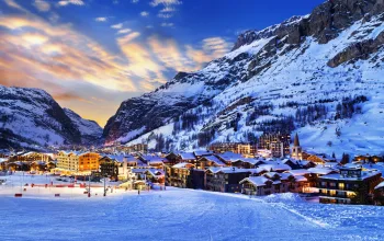
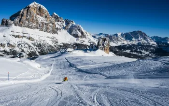
FRANCE
It’s been a fairly sunny half-term, but the clouds are rolling back over the French Alps. Plenty of snow in the forecasts, with up to half a metre on upper slopes at resorts in Le Grand Massif and Portes du Soleil.
Snow depths remain steady, especially at altitude, with several resorts still hanging onto the four metres they’ve piled up over the past few weeks. These include Flaine (150/420cm) which is among those expecting the heaviest falls – with tomorrow and Saturday overnight into Sunday the best days.
La Rosiere (220/400cm), Tignes and Val d’Isere (260/400cm) and Les Arcs (140/400cm) all remain steady, with not much shift in snow depths and around 20-30cm of new snow in the wings. Same for the Three Valleys, where Val Thorens (250/270cm) looks like picking up the most of the new snow.
Isola 2000 (120/200cm) in the southern Alps should hang onto the sun till the end of the week, and might see a modest fresh dump on Sunday
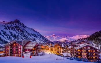
SWITZERLAND
Snow’s coming to much of Switzerland, with the Jungfrau region looking particularly blessed. The contrast on the opposite sides of the Lauterbrunnen valley is quite marked with Wengen (50/150cm) sitting on less than half the snow depth of Murren (110/435cm) And for Grindelwald (50/170cm), milder temperatures means rain at village level, and on the lower slopes, but up on the flanks of the Eiger conditions should be suitably refreshed.
Plenty of three-metre depths around the Swiss resorts and modest top-ups are due at the likes of Saas Fee (120/450cm), Verbier (110/360cm) and Zermatt (120/320cm), while Gstaad (120/200cm) will welcome the heaviest new snow – up to half a metre – with Saturday night/Sunday morning being the best time.

ITALY
It’s a different story here, and apart from the resorts close to the French or Swiss borders, there will be a lot more sunshine, with the Dolomites looking particularly bright and sunny after the steady snowfall running up to midweek.
Resorts that fared well in the last week, will again see the most new snow, though nothing heavy until the weekend. That means the likes of Prato Nevoso (120/200cm) in the north should see around 35cm, while Courmayeur (150/260cm) and Cervinia (250/415cm) will pick up about 25-30cm.
Despite the lack of much new snow in the forecast, the Dolomites are enjoying some of their best conditions. Depths have held up over much of the Dolomiti Superski domain, including Arabba (60/160cm), Alta Badia (110/180cm) and Canazei (50/240cm).
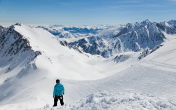
AUSTRIA
Don’t expect a lot of change in snow depths in Austria, either. Top ups of around 25-35cm will, however, refresh the slopes nicely – especially at altitude.
Temperatures here, especially in the east, won’t rise as much as in France where the warmer front will arrive from the west. But the country has not had very much snow for over a week now.

Most of the new snow will be in the west, in the Arlberg resorts such as Lech (165/240cm) and St Anton (150/390cm). Solden (155/280cm) has around 23cm forecast.
Once the half-term is over, resorts will be hoping the return of colder weather from Sunday might herald something more significant
PYRENEES
The Pyrenees are enjoying some of their best snow of the winter. Andorra’s depths may be less than half of some of the big Alpine resorts, but there is some great skiing to be had at, for example, Arcalis (80/140cm), which is forecast a mix of sunshine and snow over the next week, with heaviest falls today and Sunday.
Loads more fresh snow due in the French Pyrenees resorts such as Bareges (90/125cm) and St Lary (80/190cm) with most of the snowfall coming at night over the next few days – with around half a metre expected.
But the heaviest new snow is due on the Spanish side of the Pyrenees, where Baqueira Beret (120/180cm) and Formigal (90/130cm), especially, could end up with nearly a metre of fresh powder.
SCANDINAVIA
It’s turning snowy again in Norway and though the forecasts indicate the snowfalls will be light to moderate, expect welcome top-ups at Lillehammer (70/150cm) and Voss (75/135cm).
Over in Sweden Are (85/90cm) hasn’t seen any new snow in over a week – and doesn’t have any forecast for the next seven days either. Luckily the weather is cold enough that it’s hanging onto the snow it’s got.
In Finland, Yllas (80/90cm) still heads the country’s snow depth charts, but with a mix of mist, some sun and few flurries don’t expect much dramatic change in the next week.
REST OF EUROPE
Expect milder and foggier weather – and maybe a few flurries in Garmisch (40/405cm), while out east, it’s looking mainly sunny in Bulgaria, where Bansko (30/170cm) has some great snow at the moment, after its heavy dump last week.
No real change in Slovenia, with Vogel (70/170cm) looking mainly sunny, but that could be set to change from Sunday when some fresh snow is forecast to arrive.
SCOTLAND
Our own cold, snowy February is again keeping the slopes fresh in the Highlands, where Glencoe (100/140cm) has piled on the powder and is looking better than some European or Scandinavian resorts. The Nevis Range (50/90cm) has improved significantly too, and is expecting some more heavy snow tomorrow and Friday. And even The Lecht, which is propping up the snow league, has figures of 30/60cm.
CANADA
A quiet week is in store across most of the western side, with Revelstoke (221/269cm) still benefitting from its recent snow, even if that was mostly over a week ago. Expect a mix of mostly light snow and some blue skies over the next seven days.
If you’re heading out to Whistler (282cm) you won’t be surprised to hear that the forecast has its usual mix of snow, rain and sun to greet you. Have to say, it’s looking good up at the top, though!
Out east, there’s nothing much more than a few light flurries to trouble the scoreboard.
US
A quiet week overall in the States, too. Jackson Hole (155/226cm) continues to report good skiing conditions and might see some steadier snowfalls from the weekend.
By contrast, Steamboat (135cm) is getting its snow ration today and tomorrow and will then see the weather turn sunny for the weekend.
Apart from a little flurry on Monday, Tahoe in California (102/211cm) has had almost no interruption to its sun-filled February.
Over on the eastern side, a quiet week sees a mix of fog, sun and icy temperatures at the likes of Stowe (76/152cm).
AND FINALLY
The wind that has troubled the ski and snowboard events in South Korea, is currently lighter, but will pep up again over the weekend before dropping back early next week.
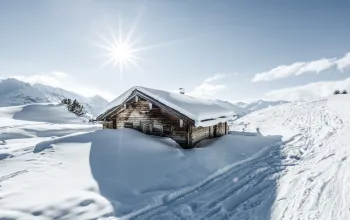
Take a break in the snow with Alpine Elements next week, and stay in the beautiful Chalet Rathia in St Anton, Austria. For just £445pp, you'll get 7 nights accommodation, half-board, flights, transfers and a great location in the world-class Arlberg ski area!
BOOK NOW
![]()