

Snow Magazine snow reports in association with Alpine Elements
![]()
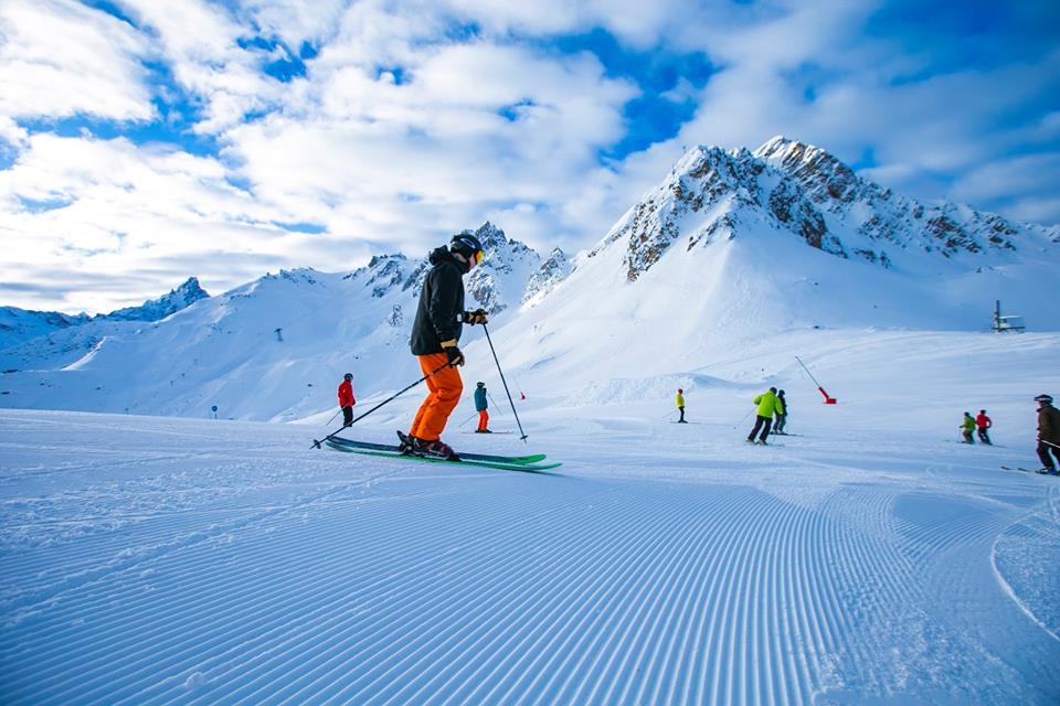
We said last week: keep an eye on Tuesday. And sure enough, yesterday saw the start of another prolonged period of heavy snowfall in the north and western Alps, with blizzard conditions in some resorts.
By this time next week, we’ll have seen more than two metres of fresh snow in the Mont Blanc area. Resorts in France’s Chamonix Valley are in line for the heaviest snow, followed by resorts in the Grand Massif and Portes de Soleil, but the west of Austria, much of Switzerland and Italian border areas such as the Aosta Valley will also see significant new snow.

However, the freeze point will rise and fall considerably over the rest of this week. So snow yesterday could give way to rain at lower altitudes before colder temperatures set in around the weekend filling the lower valleys with snow again. But by Monday that freeze point could be at well over 2,000m in some places which means more rain in many resorts and on lower slopes.
And it’s windy. This, coupled with intense blowing snow has already meant lift closures.
The current high winds should die down over the week though.
France
So, up to more than two metres of new snow are expected to pile up over the course of this week’s storm, with Chamonix (100/320cm), nearby Les Contamines (50/225cm), Megeve (90/160cm) and Flaine topping the snowfall forecasts.
It’s snowing now and been absolutely pounding down since yesterday throughout the north western Alps and it’s not going to stop before next week, which is likely to pose travel problems for people getting in and out of resorts.
The Portes de Soleil too is wallowing in new snow. Avoriaz (160/250cm) is forecast to receive 170cm, with nearly half a metre falling on Saturday alone. Even Morzine (80/290cm) is looking at 167cm of new snow over a five-day period, though by Monday expect rain in the town.
It’s interesting to note that many resorts, including Flaine (120/360cm) Val d’Isere and Tignes (230/360cm) and La Plagne (190/350cm) are close to the 4m mark and the way it’s coming down at the moment they could top that figure by the time the weekend rolls around.

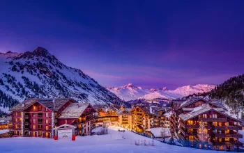
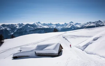
Photo: YSE Ski Chalet Holidays
Courchevel before this week’s new snow
But it’s not going to snow everywhere! Isola 2000 (140/230cm) in the southern maritime Alps, which caught much of last week’s snow, is expected to see barely a flake this time as the storm passes to the north, and has a full seven days of sunshine forecast.
Italy
Italy misses the worst of this week’s storm except in cross-border resorts such as Courmayeur in the Arosa Valley (150/250cm), La Thuile (150/230cm) and Cervinia (200/300cm), where it’s snowing hard today (Wednesday) and around half a metre or more is due.
Further east, it’s generally quieter in the Dolomites this week. For example, Alta Badia (100/180cm) should get a decent top up today, but can then expect to see a lot more sun, with only a few light flurries – but it will be much colder (down to -16 in the daytime on the mountain) over the weekend.

Austria
Western Austria is in the midst of this week’s snowstorm, so that means resorts such as Lech (105/165cm) and St Anton (80/240cm) will follow last week’s sunshine with a very healthy accumulation of between half a metre and a metre. There may be a brief respite on Sunday before it all kicks off again on Monday.
The further east you go, the lighter the snowfall. So, for example, Solden (155/280cm) saw its heaviest snowfall yesterday and today but has only a little light snow left in the forecast for the rest of the week.
It’s snowing now in the Ski Welt resorts such as Ellmau (45/120cm) but the rest of the week here too is looking quieter, though with some more snow still in the air. And it will be very windy today and tomorrow on more exposed upper slopes.
Switzerland
It’s snowing widely across Switzerland today, and will continue pretty much constantly until at least Saturday night when it will ease. By then Champery (70/180cm) in the Portes de Soleil, Verbier (90/260cm), Gstaad (120/270cm) and Andermatt (80/390cm) will have seen the biggest top-ups of up to a metre and a half.
The Jungfrau region will not be far behind with just over half a metre due in Grindelwald (50/170cm) and Murren (90/300cm), though Grindelwald will be prone to some of that falling as rain at resort level.
Photo: swissmountainview.ch holiday apartment
A quick word on Zermatt (15/300cm) which hit the headlines last week when visitors were stranded as the huge storm cut off the town. It’s snowing there again today, though not as much as elsewhere in Switzerland but Monday is currently looking like the heaviest day. With 50% of runs still closed amid very high winds, it is not quite back to normal service yet. However, where you can ski, conditions are amazing!
Pyrenees
It’s a reverse picture in Andorra, with clear skies and bright January sunshine until Saturday, when it’s set to turn snowy again, with around 30cm due in Soldeu (50/80cm) and Arcalis (70/140cm). Depths may not be as great here as in the Alps, but all the Andorra resorts are reporting ‘great skiing conditions’.
A little less sun and a bit more snow due on the Spanish side where Baqueira Beret (125/180cm) and Formigal (50/130cm) are expected to collect another half metre at the weekend.
And in the French Pyrenees, skiers in Bareges in the Grand Tourmalet region (90/130cm) and St Lary (80/190cm) can enjoy a couple of days of sunshine before the snow returns on Friday, with 30-40cm expected, before mistier conditions herald a quieter patch.
Scandinavia
It snowed heavily in Norway yesterday but a quieter week now lies ahead with light snow flurries for the rest of this week, before sunny skies return on Sunday.
Are in Sweden (90/100cm) has seen a good improvement in its snow depths in the past few days but has little new snow in the forecast. Instead, there’s a mix of sun, mist, freezing fog and very low temperatures!
In Finland, Ruka (80/90cm) still tops the depth charts, but there are only the lightest of light dustings in the country forecasts.
Rest of Europe
It’s snowing in Garmisch (30/305cm) which is catching the trailing edge of this week’s snowfall and is expecting around 40cm of new snow this week – along with some sun tomorrow and Sunday.
Bulgaria is catching a mix of sun, mist and light to heavy snow this week, with Bansko (30/120cm) running at 90% open. Heaviest snow is today and Saturday night/Sunday morning.
Scotland
Three days of moderate to heavy snow from yesterday should see top ups of up to 4ocm with Nevis Range (10/30cm) welcoming the most. Glencoe (10/40cm) is expecting 30cm which should refresh its slopes nicely. Clear skies from Friday through to Sunday, so get out there and enjoy it!
Canada
Whistler seems to be catching exactly the same snowfall pattern as the north-west Alps, with heavy snow yesterday and today, continuing until Saturday before the sun comes out on Sunday. In that time, it is expecting another 70+cm of fresh top to add to its overall depth which remains stubbornly fixed at the 185cm mark…
Photo: Mitch Winton
Indeed, it’s been knocked off its Canadian top spot by Fernie (a very precise 99/201cm) which has seen a decent drop of snow in the past week, but is now looking at a sunny rest of week with light flurries from Friday.
Elsewhere, top-ups of 20-40cm are forecast at Revelstoke (180cm), Sunshine Village (132cm), Big White (183cm) and Kicking Horse (46/142cm), with tomorrow seeing the heaviest snowfall.
Out east the ferociously cold temperatures are easing at Tremblant (61cm) which will surely welcome the 30cm of fresh snow in its forecast – though most of that is due on Monday next week.
US
Finally, a week of moderate to heavy snow means winter has at last arrived across many of the snow-starved US resorts.
Anything from around 30cm to more than half a metre of fresh snow is due from tomorrow in California at Tahoe (36/127cm), and Squaw Valley (30/97cm) from Friday in Wyoming at Jackson Hole (140/193cm) – which has already added around 70cm to its snow depths in the past week – and from Saturday in Utah, at Snowbird (132cm) and in Colorado at Aspen (56/99cm) and Vail (81cm).
Photo: Scott Bellow Photography
In the east, it’s not as cold, but there’s not much new snow about either. A mix of mist, sun and snow flurries at Killington (38/61cm) and Stowe (61/122cm) in Vermont
In Alaska, Aleyska (25/264cm) continues to head the US snow depths but from tomorrow skiers can make the most of today’s 30cm, with several days of good sun.
For the most snow in the next week, look to Mt Bachelor (107/155cm). The Oregon resort is piling it up with more than 120cm forecast.
Book your dream ski trip to Morzine with Alpine Elements for just £399pp. Includes 7 nights accommodation, half board, flights and transfers!
![]()