

Snow Magazine snow reports in association with
![]()
We’ve hit ‘peak beast’ this week, with some exceptionally cold temperatures in Europe and, of course, Snowmageddon in the UK.
But as the threat of ‘more organised snow’ threatens to plunge Britain into a new ice age, skiers here will be more concerned that flight problems will prevent them reaching the Alps where snow conditions are still superb, especially on piste.

Earlier this week saw some light flurries in the eastern Austrian Alps, but plenty of sunshine too, to take the edge off the biting cold.
Today, tomorrow into Friday and Saturday and again on Sunday night, expect to see some heavy snow across the southern French and south-western Italian Alps, topping up resorts such as Les Deux Alpes, Alpe d’Huez, Auron and Isola 2000 and across the border Prato Nevoso and Sestriere in Piedmont, Italy.
But, more significantly, milder temperatures will return from the end of this week, pushing the freeze point back up the mountains.
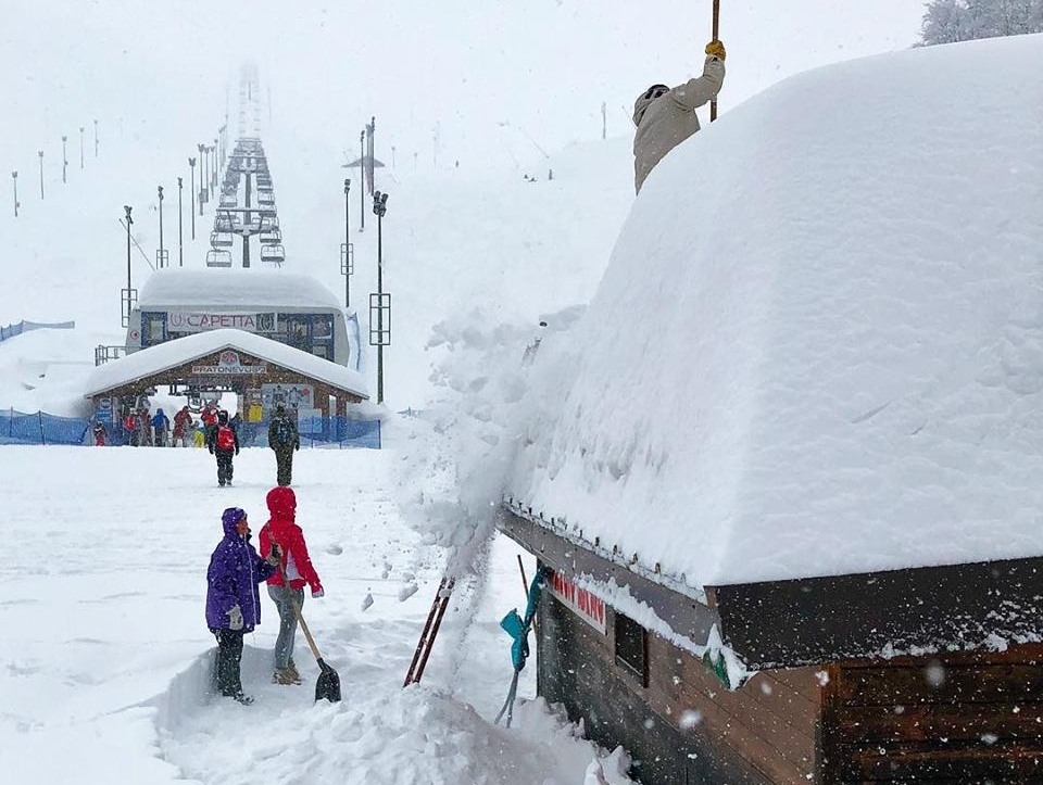
FRANCE
If it’s fresh snowfall you’re after, head for the southern Maritime Alps where resorts such as Risoul (165/225cm), Isola 2000 (120/200cm), Les Orres (130/260cm) and Auron (100/170cm) are enjoying some of their best winter conditions and awaiting this week’s heaviest new dumps of anything from half a metre to a metre.
A little to the north, Les Deux Alpes (80/200cm) and Alpe d’Huez (210/325cm) are due fresh falls of around 60-75cms, as the sun disappears after today.
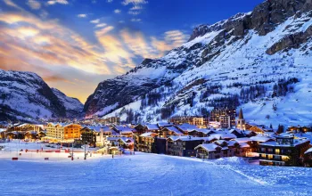
The North Western Alps won’t miss out with 30cm due at Flaine (180/450cm), over the next few days. Avoriaz (270/370cm), which hasn’t seen any new snow for well over a week, gets a healthy 25-30cm refresh, as does Les Arcs (140/390cm). And there are similar top-ups of 30+cm for Tignes and Val d’Isere (230/370cm), Courchevel (210/310cm), Val Thorens (240/280cm) and Chamonix (100/405cm). Heaviest snow will probably fall on Saturday.
SWITZERLAND
Yesterday, Zermatt (140/350cm) had daytime resort temperatures of -24C. By Tuesday next week that will have risen to the tropical heights of -2C. In between the town will have accumulated getting on for another half-metre of fresh snow.

In general, though, Switzerland is in for a week of gradually rising temperatures, steady snowfall – occasionally heavy – with totals of around 25-40cm. Adelboden (50/205cm) might hit half a metre, but most of the country’s resorts will fall just short of that mark.
You might get a glimpse of the sun in Saas Fee (120/475cm), or Wengen (50/170cm) and elsewhere, on Saturday, before the clouds roll back in on Sunday and pour their fluffy hearts out again on Monday. The sun may linger through Sunday and into next week in Verbier (90/355cm) and Crans Montana (100/360cm), with patchy moderate falls almost anywhere.
ITALY
It’s almost a carbon copy of last week’s forecast for Italy, where Prato Nevoso (120/200cm) in Piedmont is once again proving to be an Italian snow magnet, staring at a week of heavy snowfall, amounting to nearly a metre in all. Its Piedmontese neighbour of Macugnaga (200/250cm) is forecast a mere half-metre.
Slightly more moderate snowfall is expected across much of northern Italy in the coming week, and the Monterosa resorts, such as Gressoney (110/270cm), Courmayeur (145/250cm) and Zermatt’s neighbour, Cervinia (270/400cm) will see accumulations of 35-40cm, with the heaviest coming on Sunday night, after a possible sunny respite during the day.
A little less new snow predicted in the Dolomites, but respectable, steady light snow should see top-ups of 20-35cm in Arabba (130/160cm), Canazei (50/140cm) and Alta Badia (110/180cm), before the new week brings the onset of some more significant falls.

And everywhere in Italy, temperatures are rising back towards seasonal norms as we look forward to a stronger than usual March.
AUSTRIA
Three days of steady but modest snowfall from tomorrow will see accumulations of around 15-20cm in many Austrian resorts that have seen little fresh snow for over a week, including Solden (155/330cm), Schladming (90/160cm), Lech (165/310cm) and St Anton (125/370cm).
Again, temperatures will rise from yesterday’s extreme -20°C range, back towards zero.
The cold has helped preserve Austria’s snow and conditions are generally good with decent depths at the higher altitudes, so head up the mountain for some great ski opportunities!
The likelihood of new snow is far from universal, however. Kaprun (50/310cm) is forecast a week of sunshine, with only a few occasional flurries. Similarly, the huge Ski Circus area, including Saalbach (120/230cm) looks set for sunny days, with a little snow at night.
PYRENEES
Europe’s ‘other’ mountain range is still revelling in all the new snow they’ve had. A real mixed bag lies ahead, with patchy moderate snow alternating with bright sunshine and temperatures generally rising, in Andorra for example. While in the French Pyrenees, St Lary (80/190cm) is contemplating a week of bright sunshine, punctuated by either heavy rain or snow with thunder, sleet and some proper snow. The rising freeze point looks set to have a say in where the rain stops and the snow starts.
A little more cloud generally on the Spanish side, where Formigal (90/250cm) has around a metre of fresh snow coming, starting with a big dump today. Less due in Baqueira Beret (130/210cm) which could see a mix of sleet, snow and sunshine.
SCANDINAVIA
Plenty of bright March sunshine in evidence in Norway, where Voss (90/260cm) continues to ski beautifully. Not much new snow in the forecast, however.
Likewise in Sweden, where Are (85/90cm) will see a bit more cloud, but no significant new snow. Single-figure snowfall in Finland, where Saariselka (80/100cm) will see its first new snow (albeit light) since the end of January. And remaining cold, so it should stick around.
REST OF EUROPE
A couple of decent dumps of 10cm+ in Bulgaria amounting to around 35cm in all for Bansko (100/220cm) and Borovets (140/190cm).
More light to moderate snowfall in Slovenia, with Monday the heaviest day, but with temperatures on the up here, that could spell rain at resort level for the likes of Vogel (100/190cm)
In Germany, the Beast from the East brought -30.5°C - the coldest temperature in a century - to the top of the Zugspitze, but after a foggy week and as it gets warmer by Monday, it’ll be +4°C and raining in resort at Garmisch (50/380cm) but should still see plenty of good skiing on the pistes.
SCOTLAND
Scotland’s heaviest snowfall is forecast for the east of the country, but we’ll still see a week of steady light snow at Glenshee (80/100cm) while Glencoe (150/200cm) mostly misses out.
Just don’t expect too much, sorry, anything, in the way of sunshine. But who needs sunshine when snow is falling?
CANADA
Patchy, light to moderate snow and then the sun pokes through again over most of the BC resorts, such as Whistler (297cm), Sun Peaks (173/229cm) and Big White (290cm), where around 10-20cm is on the way.
A bit more cloud, but only light snowfall in Alberta, where Sunshine Village (185cm) and Lake Louise (150/220cm) can expect single-digit falls.
But even that is more than is due at Tremblant (61cm) which has a mere 2cm, which would be described as the Snowpocalypse in London, of course…
US
The season has been slowly picking up at many of the traditional big names in Utah and Colorado, such as Park City (114/140cm) and Aspen (213cm) but further north in Wyoming, Jackson Hole (188/257cm) continues to outski the rest.
But the week ahead should see further much-welcome top-ups of 20+cm at Snowbird (224cm), Northstar at Tahoe in California (46/132cm) and Sierra (124/262cm) with the heaviest falls on Friday.
In Oregon, the mighty Mount Bachelor (254/272cm) is forecast another 35cm, with the prospect of a few rumbles of thunder on Friday or Saturday.
In Alaska, the glorious sunshine gives way to a few centimetres of fresh snow at Aleyska (50/260cm).
Out East, it’s a quiet, generally snow-free week ahead at New England resorts like Stowe (61/122cm)
AND FINALLY
The resort in Europe that’s forecast to get the most snow this week – a massive 183cm – is not in the Alps, nor even the Pyrenees, but is in fact Europe’s most southerly - Sierra Nevada, in Spain, barely two hours’ drive from the beaches of the Costa del Sol. They are due blizzard conditions with half a metre on each of tomorrow and Friday, and further fat dumps on Sunday and Tuesday after, amazingly, blue skies on Saturday and Monday.
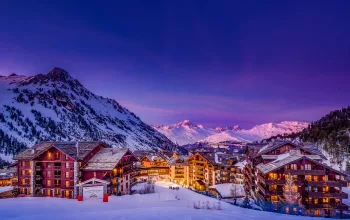
The 'Beast from the East' has left behind some superb conditions in the Alps, so now's the time to head out and enjoy the snow! Stay at the 4-diamond, Hotel Gelinotte in Val d'Isere, just 5 minutes from the slopes for just £735pp on the 11th March! Includes 7 nights accommodation, half-board catering, flights and transfers.
BOOK NOW
![]()