Snow Magazine snow reports in association with
![]()
The February half-term is just around the corner and the weather is behaving like a restless child itching to get out of the classroom, but having to stay calm to avoid detention.
Things are looking settled for a bit, after this week kicked off with some moderate to heavy snowfalls in the SW Alps (which is good news for French/Italian border areas), and a few lingering snow showers. Across most of the major Alpine resorts, the expectation is for several days of fine, sunny, but chilly weather, with hardly a flake in sight until Monday next week.
There are a few isolated Swiss and Austrian mavericks, such as Zermatt, the Jungfrau region, and Solden, where light snow showers will hang about till the weekend. And most Italian resorts, especially those where it’s snowing today, such as the far west and across the Dolomites, will see less sun and a few more flurries through till Friday, but the overall picture is good, with nothing like the dramatic storms we saw in January…yet.
Across the Atlantic, the snowiest outlook is for the Eastern US and in Alberta in Canada.
FRANCE
A mostly quiet week ahead, with temperatures staying cold, spells good news for piste skiing, though the off-piste remains variable.
Snow depths remain impressive, especially at altitude, with several resorts still hanging onto the four metres they’ve piled up over the past few weeks. These include Flaine (150/420cm) so good news for La Rosiere (220/400cm), Tignes and Val d’Isere (260/400cm) and Les Arcs (140/400cm).
Best new snow has come in the southern Alps, where Isola 2000 (120/200cm) and Risoul (165/225cm) are reporting great skiing conditions.
SWITZERLAND
The French pattern is repeated across much of Switzerland, with a sunny week expected at the likes of Gstaad (120/200cm), Crans Montana (100/550cm) and Verbier (100/360cm). A little more cloud at Andermatt (140/510cm) and Klosters (90/180cm).
Zermatt (120/320cm) and Saas Fee (120/450cm) buck the trend with moderate snowfall from today until Friday, totalling up to 30cm.
ITALY
Italy could see the most new snow this week, though new falls will mostly be steady rather than heavy. Prato Nevoso (120/200cm) in the northern Italy province of Piedmont did get some heavy snow yesterday, and accumulates more today. Flurries will linger till Saturday when it too will see a few days of settled sunshine.
The Arosa valley (Gressoney 100/250cm) and French/Italian border resorts along with Cervinia (250/415cm) will also hang onto some snow showers.
Top-ups of up to 20cm amounts are forecast for the Dolomites which also saw some fresh snow last week. Depths have held up over much of the Dolomiti Superski domain, including Arabba (60/160cm), Alta Badia (110/180cm) and Canazei (50/240cm).
AUSTRIA
There’s a mix of sunny skies in the west and a bit more cloud and light snow elsewhere, but apart from Solden (155/280cm) with 14cm, nowhere else is forecast anything more than slight single-digit dustings.
So, in all, a relatively quiet week as we head towards the half-term. Most resorts are reporting great on-piste skiing conditions with snow depths holding up well at Lech (165/240cm) and St Anton (150/390cm).
Lower resorts such as picturesque Zell am See (20/145cm) will pray the weather doesn’t heat up too much.
PYRENEES
A bumper storm at the start of this week has left the Pyrenees wallowing in new snow. Andorra has had a helpful fall of fresh snow over the past few days and Grandvalira (60/130cm) is typical of the province with great skiing all over its terrain.
As for Arcalis (80/140cm). Well, just watch this:
Loads of fresh snow too for the French Pyrenees resorts such as Bareges (90/125cm) though the outlook is now more settled with plenty of sun and blue skies. Watch out for a change next Monday, when some more heavier snow could again be on the way.
There’s a mix of a little new snow and decent sunshine for the coming week over on the Spanish side too, where Baqueira Beret (120/180cm) and Formigal (90/130cm) are forecast to get a welcome double-digit top-up.
SCANDINAVIA
Snow depths have remained steady at Are (85/90cm) helped by around 15cm of fresh snow in the past week. The next few days again see a mix of sun and light flurries.
Lillehammer (70/150cm) still tops the Norway snow depth charts, but the snowiest week here will be in Voss (75/135cm) with around 35cm of fresh snow due – just like last week – with Friday looking like the biggest whiteout day.
In Finland, Yllas (80/90cm) is due the most new snow, but nowhere is breaking the 10cm mark, despite several days ahead of steady but light snow.
REST OF EUROPE
Garmisch (40/405cm) in Germany has held onto its four metres – just – but nothing much is forecast for the coming week, which will mainly be fine, with just a little light snow Thursday and Saturday.
Some heavy snow is falling in Slovenia tomorrow, with Vogel (70/170cm) expecting around 30cm, but it’s mostly light snow and a few glimpses of sun after that.
If it’s heavy snow and abundant fresh powder you want this weekend, head to Bulgaria, where Bansko (30/50cm) is expecting up to half a metre from Saturday through till Monday.
SCOTLAND
Scotland is enjoying a good week for new snow, and once again Glencoe (50/120cm) and Nevis Range (40/70cm) are the main beneficiaries. Nevis has doubled its snow centimetres over the past week, and Glencoe continues to post impressive depths – and show us some fabulous scenery! Scotland is definitely having good winter!
CANADA
Whistler (297cm) continues to see-saw as the warmer coastal temperatures bring another mix of rain in the resort and snow up the mountain. Once today’s rain and snow combo move away, there’s plenty of sunshine about for the week ahead.
Across the Rockies, it’s going to be colder in Alberta with a little new snow and plenty of sunshine. And just over the border BC’s Revelstoke (246/271cm) has improved its snow depths and looks to add another 30cm today and tomorrow before a few days of good sun. Expect some great powder skiing there!
US
A mix of sun and some new snow should help pep up Vail in Colorado (86/86cm). Meanwhile Jackson Hole (163/229cm) has had another good week and is celebrating some great powder skiing as only it can…
Park City (74/99cm) in Utah is looking to Saturday for some much-needed heavy new snow. And the eastern resorts such as Stowe are going to see temperatures plunge again after today’s snowfall.
California is forecast wall to wall sunshine for the next week, with maybe some light snow on Saturday night
AND FINALLY
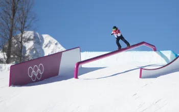
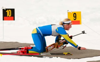
The Winter Olympics get under way from Friday in South Korea, where the temperature today is -18C, and snow flurries are forecast from Saturday. It’s going to be icy and lightning fast…
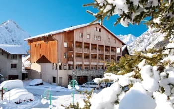
Why not take a February ski break to Tignes with Alpine Elements? Stay in the charming Chalet Neve for just £640pp, including half-board, 7 nights accommodation, flights and transfers!
BOOK NOW
![]()