Snow Magazine snow reports in association with
![]()
With the beast now back in its cage, normal weather systems are reasserting themselves over the Alps.
That sees the freeze-point yoyo over the coming week, climbing to well over 2,500m in many places by the weekend, before falling away again at the start of next week. And, for many resorts, that means a messy mix of snow, then rain, then snow again at lower levels, while the highest slopes look set for steady top-ups of around half a metre or more.
The new snow will be relatively widespread, with the French Alps, Italy and Switzerland all forecast to get decent falls, and only a bit less for Austria.
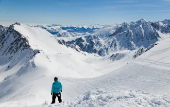
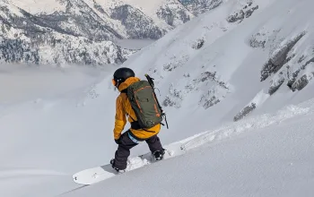
Snow conditions in the Alps are still generally very good for March though the rainfall will make home runs pretty mushy. And a sad spike in avalanches recently with a number of fatalities means special care needs to be taken off-piste.
FRANCE
Last week it was the southern Maritime Alps that took the lion’s share of fresh snow with Risoul (200/265cm) and Isola 2000 (155/250cm) adding a solid 40cm+ to their snow depths.
Although they can still expect a welcome 30cm, the snow epicentre moves a little further north with Les Deux Alpes (80/200cm) and Alpe d’Huez (215/340cm) due a very thundery mix of 60-70cm of snow (and some rain) today and again from Saturday.
The North Western Alps too, can expect significant snowfalls, with nearly half a metre due at Flaine (180/420cm), from Saturday. It’s a similar picture in the Portes de Soleil where again Saturday through to Monday should see plenty of new snow on the higher slopes above Avoriaz (270/385cm), but rain down in Morzine (50/200cm).
Expect a little more sunshine than snow showers in the Three Valleys, where Meribel (90/340cm) and Courchevel (220/325cm) nevertheless have around 25cm of new snow in the forecast.
SWITZERLAND
Switzerland sees a quiet couple of days, with tomorrow looking especially sunny, before the weather closes in with a mix of snow and rain, depending on altitude, from Saturday. In general, anything up to 40-50cm of new snow could fall, but if you’re mooching around lower resorts such as Grindelwald (50/230cm), Gstaad (30/200cm) or Adelboden, (30/205cm) you’ll need an umbrella.
Recent top-ups mean good conditions still prevail, especially on the upper slopes, and current depths remain strong at Saas Fee (120/475cm), Verbier (100/340cm), Crans Montana (65/360cm) and Engelberg (40/590cm), where any new snow will be more patchy, and accumulations closer to 20cm.
ITALY
Looks like there’s going to be a lot of fog about across Italy’s main ski areas, but with a sizeable dollop of snow today and again from Sunday, though again, the rising freeze-point signals rain at lower levels.
And while the snow magnet is again Prato Nevoso in Piedmont, this time it’s joined by the lesser-known resort of San Martino di Castrozza (50/160cm), just to south of the main Dolomites/Sella Ronda, which looks set to soak up half a metre or so, over tomorrow, Sunday and Monday, though that will fall as rain in resort.
And the Dolomites in general could end up with around 40cm+ of fresh snow on upper slopes, with the freeze point dropping back below 2,000m from Monday.
Meanwhile, Prato Nevoso, which stood at 120/200cm this time last week is now posting snow depths of 180/350cm – that’s a metre and a half added to the upper slopes!
AUSTRIA
West is best in Austria over the coming week, if it’s new snow you’re looking for. Following moderate falls today, the Arlberg region looks set for a couple of sunny days tomorrow and Friday before the clouds roll in for three days of snowfall. Lech (165/310cm) and St Anton (125/360cm) are forecast accumulations up to 40cm.
A bit less due at Solden (165/320cm), Obergurgl (185/245cm) and Ischgl (100/170cm), but still topping 30cm, while the rule of thumb for most of Austria is top-ups of around 20cm.
Again, temperatures seesaw a bit, but as clear skies return from Tuesday, the freeze-point is hovering just below the 2,000m mark.
PYRENEES
Over in the Pyrenees, the story is much the same – a mix of snow and rain, depending where the freeze point settles. For the French side, that looks like going up to 2,700m+, which is not good for precipitation!
Bareges (130/170cm) and St Lary (80/190cm) have half a metre due, while over the border, Formigal (110/280cm) is forecast 90cm, with tomorrow and Saturday set for the heaviest dumps.
Andorra somehow misses out on the heavy stuff, with little more than around 10-12cm for Arcalis (145/250cm) – but some decent sunshine on Friday.
SCANDINAVIA
Cloudy, light snow, remaining cold – Norway’s resorts can expect an undramatic week, with the most snow coming at the start of next week. A little March sunshine this week, however. Snow depths are still good – Hemsedal has 175cm, Voss 90/270cm.
Likewise in Sweden, Are (100/105cm) has strengthened its snow depths but is only forecast a few days of light snow. And once again, little more than single-figure top-ups in Finland, where Saariselka (80/100cm) stays top of the pile. And there’s little sign of spring, as temperatures remain double digit minus.
REST OF EUROPE
Expect a sunny week ahead in Bulgaria with a modest 20-25cm of fresh snow for Bansko (100/280cm).
Slovenia’s had some massive snow lately. And now it’s warming up, and with it comes rain at low levels and about half a metre of fresh snow up the mountain in Vogel (150/300cm)
It’s getting significantly warmer in Germany, where Garmisch (40/230cm) will see temperatures of 10C from Saturday and a bit of thundery snow/rain on Monday.
SCOTLAND
Seems a bit pointless to talk snow for Scotland, given what the whole country has been experiencing lately. And there’s a bit more to come, with around 15cm at Glencoe (150/250cm) and 10cm at Nevis Range (50/150cm).
CANADA
There’s fresh powder around at Big White (325cm) which has added more than 30cm to its snow depths. But the week ahead looks light and quiet here and over most of Canada, with less than 10cm of fresh snow due.
Only exception to this is Whistler (305cm) which has 23cm in the forecast, mostly falling tomorrow and Friday, but as is so often the case here, milder temperatures will mean rain in resort.
Out east, even the several days of light snow flurries forecast for Tremblant (61cm) will be welcome in a resort that has seen little in the way of big dumps this season.
US
Slow to start, big recent snowfall has been a shot in the arm for Californian resorts such as Squaw Valley (165/290cm), Sierra at Tahoe (277/478cm) and Mammoth (203/330cm), although they have also seen a spike in avalanches. Plenty of sunshine about to enjoy all that new snow over the coming days with only a moderate top-up of less than 10cm due this weekend.
And apart from a blast of thundery snow on Friday, sunshine is the pattern for Jackson Hole (211/297cm) which has also seen significant new powder of late.
More new snow has arrived in the East, too, where the likes of Killington (46/71cm) and Stowe (61/122cm) will relish the 20-30cm of fresh snow that will accumulate over the next few days.
AND FINALLY
Sierra Nevada, in Spain, is now posting snowfall depths of 50cm on the lower slopes and 220cm at altitude after huge dumps last week. As if all that fresh powder wasn’t enough, it’s expecting another half-metre over the next four days.
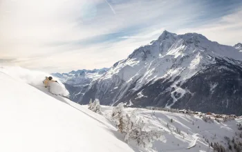
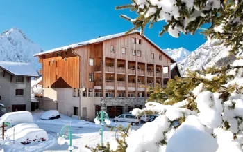
Take a ski break in Val d'Isere with Alpine Elements and make the most out of the end of season deals! Stay at Chalet Fjord, a central hotel with stunning mountain views, for just £594pp for 7 nights accommodation beginning 11th March! Also includes half-board cateing, flights and transfers.
BOOK NOW
![]()