Snow Magazine snow reports in association with
![]()
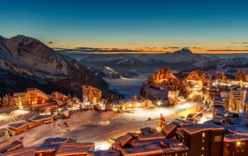
As we head towards ‘peak winter’ when the numbers of skiers and boarders heading to the slopes rises sharply, thousands will be now asking if February will see as much snow as January.
Well, January has gone out on a settled sunny note with several days of the kind of blue skies and warm sun that fills restaurants’ outdoor terraces right across the Alps.
And now February kicks off with colder temperatures and a return to snowy conditions for at least the next five days, with the heaviest new snow in the northern French and Swiss Alps, and lesser falls across Italy and Austria.
At the moment it looks unlikely that we’ll see severe storms, with forecast accumulations of just up to half a metre. But with the freeze-point dropping, hopefully even the lowest slopes – decimated by recent rain – will be replenished. Friday night looks likely to be one of the coldest so far, getting down to -19C in some places.
FRANCE
A week of more settled weather will have come as a relief to many resorts overwhelmed by recent record snowfalls. But they’ll now welcome the expected top-ups, especially at lower resorts where home runs were getting especially mushy by late afternoon.
Snow depths remain impressive, especially at altitude, and most new snow is expected again in the northern Alps, so good news for Chamonix (100/230cm), Samoens (110/315cm), Morzine (80/360cm), Tignes and Val d’Isere (260/400cm) and Les Arcs (140/400cm).
There could be a break in the snow on Saturday in the Three Valleys, where Courchevel (220/330cm) and Meribel (125/330cm) and Val Thorens (250/270cm) can expect a sunny transfer day. It’s a similar picture for Megeve (90/240cm) and Alpe d’Huez (200/260cm).
Brightest spot of all remains the southern Alps, where Isola 2000 (120/200cm) should get nothing more than a few light flurries tomorrow and Sunday.
SWITZERLAND
The French pattern is repeated across much of Switzerland, where it’s been generally sunny over the past week. Decent snowfalls from tomorrow of just under half a metre over five days at resorts such as Gstaad (120/200cm), Andermatt (140/510cm) and Champery (100/360cm).
Meanwhile Crans Montana (100/550cm) has joined Engelberg (60/555cm) at the five and half metre mark.
The quieter week has brought a lot of relief to Swiss resorts that have been racking up the metres in such a short period of time, meaning all can look forward to the coming top-ups. And the chillier temperatures after such a mild week, will help lower resorts such as Grindelwald (50/170cm) which is an important hub resort for the Jungfrau region, and Verbier (100/360cm) which, even sitting at 1500m, saw way too much rain a week ago.
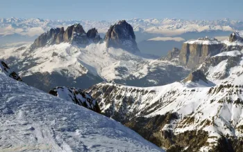
ITALY
Italy is skiing pretty well so far, despite generally missing out on the biggest snow – although the recent milder temperatures have affected lower slopes.
And there’s plenty more sunshine over the week ahead, punctuated by some new snow – heaviest on Thursday and Sunday. The biggest beneficiaries are likely to be the Arosa valley and French/Italian border resorts such as Courmayeur (150/260cm) and La Thuile (100/290cm) with around 25cm.
Similar amounts are forecast for the Dolomites which have not seen any new snow for a week. Top-ups expected of 25cm in Arabba (60/160cm), Cortina (50/150cm) and Canazei (50/240cm).
AUSTRIA
It’s been a lovely sunny week across Austria and there’s a happy mix for the week ahead of sun and around 35cm of new snow. Schladming (80/110cm) tops the forecast table, while big hitters such as Lech (165/240cm) and St Anton (150/390cm) will get 25-30cm – their first new snow in over a week.
Snow conditions are generally holding up well in Austria, especially at altitude, though the lower resorts such as Soll (80/170cm) will welcome the colder temperatures along with some new snow.
PYRENEES
It was a snowy weekend for the French Pyrenees resorts such as St Lary (80/190cm) where around half a metre of fresh snow preceded a few days of blue skies. The week ahead is a mix of sun and more snow – with around 20-25cm due.
On the Spanish side Baqueira Beret (120/180cm) and Formigal (90/130cm) have had some fresh snow too and are forecast another 30+cm, broken up by a sunny Saturday.
That same snowfall pattern will bring slightly less new snow to Andorra, where Grandvalira (60/130cm) is reporting great skiing conditions.
SCANDINAVIA
It’s snowing in Lillehammer, Norway (70/150cm) where conditions are good but while most resorts can expect slight top-ups, Voss (75/135cm) will again claim the lion’s share of new snow with another 30+cm on top of 13cm last night.
Snow depths have fallen back at Are (85/90cm) but at least it’s snowing now. Looks like around 15cm of fresh snow over the week ahead
It’s going to be a foggy week for Finland, until at least Monday.
REST OF EUROPE
Some heavy snow is on its way to Slovenia tomorrow, with Vogel (80/170cm) expecting around 80cm. Garmisch (40/475cm) in Germany has piled on the new snow, but will see a mix of sun and light snow this week.
A quiet week out east in Bulgaria too, where Bansko (30/50cm) will see around 15cm of fresh snow, mostly on Saturday.
SCOTLAND
Snow depths continue to yo-yo here. Once this week’s high winds have died down there should be some good fresh snow about, especially at Glencoe (20/80cm) and Nevis Range (20/40cm)!
CANADA
Whistler (323cm) continues to confound. It has added another half-metre to its snow depths over the past week, but warmer temperatures to well up the mountains have resulted in variable conditions. This week, though looks a bit colder again.
It’s a decent week across much of Canada, which big name resorts such as Revelstoke (221/239cm), Sun Peaks (160/185cm) Fernie (145/269cm), Lake Louise (127/163cm), Panorama (79/124cm) and Marmot Basin (104cm) all due to collect around 15-30cm, along with some sunshine too.
US
There’s a sign that winter might at last be turning a corner in the US. Vail, which is struggling with just 90cm could see another 20cm with a rare Colorado snow storm kicking in from Saturday night to really put a better face on its season.
Jackson Hole (152/218cm) continues to tick over nicely, and looks set to accumulate another half metre in the coming week.
In Montana, Whitefish (135/201cm) is expecting a steady week of snow with 30+cm, and while conditions remain variable at many Utah resorts such as Park City (79/114cm) there’s a hint of snowier weather to come on Monday.
California and Oregon have fared better, with Mt Bachelor at 173/229cm after some hefty new snow in the past week, and Mammoth (102/213cm) and Tahoe (102/213cm) also looking good, though here a week of double-digit temperatures and solid sun may see those depths fall back over the next seven days.
In the East, there’s not much new snow about either, though it’s going to be cold enough to get the snow cannons fired up. And in Alaska, Aleyska (28/259cm) can expect a fairly sunny week with not much new snow due.
AND FINALLY
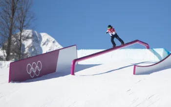
It’s currently cold and getting colder in South Korea ahead of the Winter Olympics this month.
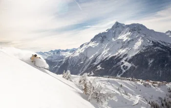
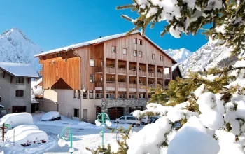
Why not book an amazing half-term ski holiday in the French Alps from as little as £650pp? Stay in the Chalet Fjord in Val d’Isere to make the most of the amazing snow conditions!
BOOK NOW
![]()