Snow Magazine snow reports in association with
![]()
After the snow and rain of last weekend, the next couple of days bring a mix of mist, fog and sunshine in many alpine areas, before the temperatures drop again and snow returns to many resorts.
But the forecast amounts are moderate compared with what many resorts have just gone through. Last weekend the snow piled up yet again in the northern French Alps, most of Switzerland and western Austria.
And the problems piled up too, with some resorts, such as Zermatt, again cut off. Vast tracts of ski areas were closed as avalanche alerts hit the maximum five; lift and slope closures also restricted the piste skiing in many places. It was a similar story in Val d’Isere and Tignes and Western Austria, with avalanche risks at maximum
Moreover, poor visibility blighted many areas that did stay open. In France, Chamonix-Mont Blanc, the Portes du Soleil and Grand Massif ski areas have all seen temperatures seesaw up and down as heavy snow turned to heavy rain at low levels.
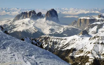
In Italy, the Dolomites avoided the heaviest snow, but will take its turn this week, with the Arosa valley forecast to be one of the few bright spots for sunny skies. For those lucky enough to get a glimpse of the sunshine, it looks like there are some outstanding conditions right now if you know where to look.
FRANCE
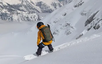
Finally, after several days of freakishly heavy snow (and, sadly, rain below 2,200m) we are at last seeing a bit of sunshine. There’s a bit of murk about, too, with some very photogenic temperature inversions!
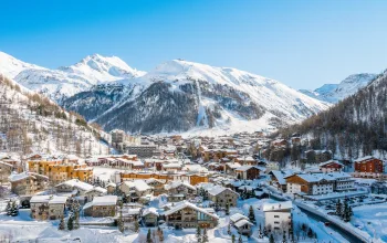
Sunday and Mondays’ rain was forgotten as the sun finally broke through in Val d’Isere (280/380cm), Chamonix (100/230cm), Avoriaz (240/370cm), Chatel (60/190cm) and Flaine (150/420cm).
Flaine is now one of four French resorts with snowfall depths topping four metres – Les Arcs, Peisey Vallandry and La Rosiere being the others, but really, huge amounts have fallen almost across the board.
Moderate dumps of up to 20cm and colder temperatures could help some lower resorts recover a bit on Friday, before a weekend mix of some sun and mist.
Brightest spot of all, however, is the southern Alps, where Isola 2000 (120/200cm) is again expecting glorious sunshine almost every day, except Friday.
SWITZERLAND
It’s a similar story in Switzerland, with the heavy snows (and rain) of the weekend being followed by a mix of fog and some sun, and a snowy day again on Friday.
For many resorts, that offers the chance to do some much-needed avalanche safety work and dig out lifts buried by the remarkable snowfall.
Engelberg has now got 530cm at altitude and Andermatt (100/450cm) has the second highest Alpine total. A calmer week is in store for Champery (70/180cm) in the Portes du Soleil, Verbier (100/350cm), Gstaad (120/270cm) and Saas Fee (120/380cm).
Zermatt (190/320cm) was cut off again, and has seen a total shutdown along with avalanches and evacuations. A quieter week before a 20-30cm fall on Friday/Saturday, might at least see some restoration of normal service.
ITALY
Here, for once, it’s the Dolomites that can expect to see to heaviest new snow this week, with around a metre expected in Cortina (50/150cm), Canazei (50/240cm) and Arabba (60/160cm).
Last weekend’s storm hit cross-border resorts such as Courmayeur (150/250cm), La Thuile (100/250cm) and Cervinia (240/355cm), all of which will see a mix of sun, murk and patchy snow on Friday.
AUSTRIA
Western Austria took a similar pounding last weekend and St Anton was on emergency avalanche alert. There were real fears for some smaller mountain villages amid talk of evacuations.
Resorts such as Lech (190/280cm) and St Anton (180/420cm) nearly doubled their snow depths and will need the respite offered by the calmer weather this week (mix of sun and misty conditions) before another modest top up of around 20cm over Friday and Saturday.
The further east you go, the lighter the snowfall. So, for example, Saalbach Hinterglemm (120/230cm) had half as much as St Anton. But again, a quieter week is in store, with a drop of fresh snow on Saturday.
PYRENEES
A sunny start to this week for Andorra, with clear skies and strong sunshine until Thursday night, when a light dusting will refresh the slopes at Arcalis (80/140cm).
Plenty of sunshine in the French Pyrenees, too, after the weekend snow, but Bareges (90/125cm) and St Lary (80/190cm) can expect to see a top-up on Thursday night, into Friday morning.
It’s the same story on the Spanish side where Baqueira Beret (120/180cm) and Formigal (90/130cm) are reporting great snow conditions.
SCANDINAVIA
In Norway, Voss (75/130cm) is set for a snowy week, with more than half a metre in the forecast, though the rest of the country’s resorts should see less snow and a lot more sun.
A mix of light snow and sunshine over the border in Sweden, too, where Are (90/100cm) will welcome even a light dusting!
A quiet week ahead too for Finland, where Ruka (80/90cm) still tops the depth charts.
REST OF EUROPE
Garmisch (30/305cm) in Germany is still looking good, and will also enjoy some sunny days followed by fresh snowfall on Friday night.
A sunny week and no real snow for Bulgaria where Borovets (50/110cm) has double the snow depths of Bansko (30/50cm). Seems winter hasn’t not quite got going here yet.
SCOTLAND
The Highlands have seen a decent top up of snow, though as usual, the high winds have left it a little windblown. A windy week with some fresh snow – but rain too – will be generally good news for Glencoe (50/110cm) and Cairngorm (30/70cm)!
CANADA
Whistler (284cm) has added a metre to its snow depths over the past week, and with temperatures staying well below zero, and more fresh falls in the forecast, the skiing here is now incredible.
Photo: Megan Wilson
It’s a good week too, for most of the rest of the country, with healthy accumulations
of 20-30cm forecast at Revelstoke (198cm), Fernie (99/221cm), KJimberley (104cm) and in the east too, where it remains very cold.
US
Conditions have improved a lot in the last week or so across the US, and some modest fresh snow is likely almost anywhere, though Mt Bachelor (135/175cm) has the most due, at around half a metre.
A happy mix of sun and fresh snow should keep things ticking over at Squaw Valley (46/109cm), Tahoe (53/150cm) and Jackson Hole (130/191cm).
In the east, there’s not much new snow about either, but in Alaska, Aleyska (25/264cm) continues to head the US snow depths and again should see several days of good sun.
Make the most of the amazing snow with a Family Ski Holiday to La Plagne with Alpine Elements. From just £569pp, including 7 nights accommodation, half board, flights and transfers!
BOOK NOW
![]()